Jebel el Kest
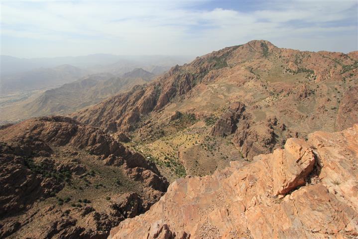
The tremendous massif of Jebel el Kest forms the northern bank of the Ameln Valley, and the backbone of the Anti-Atlas mountain range to the north of Tafraout. The highest point on the escarpment, Afa-n-Tmezgadiwine, sits at 2375m (7792ft) above sea level, and is generally referred to simply as 'Jebel el Kest'.
The whole escarpment runs for some 22 miles (35km) from the pass of Tizim Waylim (1745m) above Tanalt in the west to the mighty Tarakatine Pass (1655m) in the east, over which the main Agadir to Tafraout road passes before descending into the Ameln Valley. The ridge gains and maintains in excess of 2000m above sea level for its entire length.
This massive mountain range dominates the Anti-Atlas, defining its geography, shaping its landscape, and influencing its people. It is the provider of water to the hundreds of settlements that outline its periphery and, not surprisingly, is one of Tafraout's most important tourist attractions.
Adventure companies guide clients to this magnificent summit throughout the year, often ascending from the Ameln valley with an overnight stop in Tagdicht, from where the mountain presents its easiest line of ascent. The walk from the village involves approximately 1000m of height gain in just over 4km, making for a steep and challenging hike that is popular with tourists from within Morocco as well as overseas.
From Anergui, Jebel el Kest is hidden, and the way is less obvious. But for climbers it presents a more interesting solution: a slightly shorter walk, less height gain, and the tempting possibility of combining an ascent with some tremendous mountaineering.
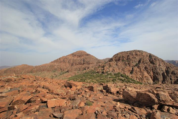
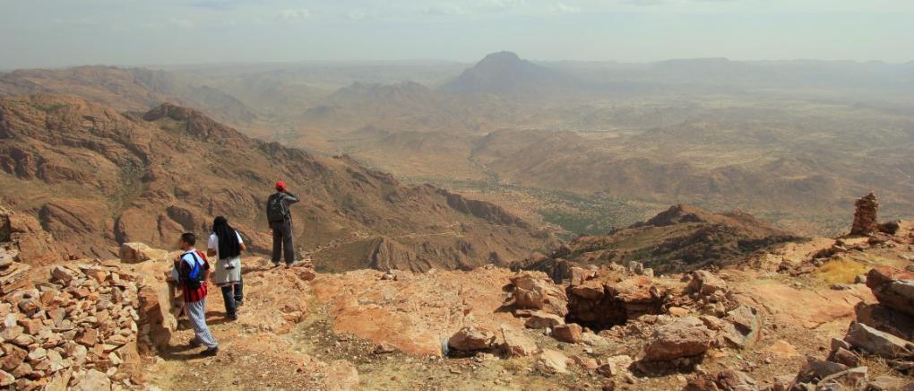
The view from the summit is nothing short of spectacular, and on a clear day it is possible to see as far as the Atlas Mountains, the Atlantic Ocean and the Sahara Desert all at the same time – an unparalleled privilege, and one of the highlights of any trip to the Anti-Atlas. An ascent, therefore, is not only strongly recommended, but also a rite of passage for repeat visitors to Tafraout willing to expend a bit of energy.
Afa-n-Tmezgadiwine Summit
Attaining the summit of Jebel el Kest is a challenging hike over rough terrain, but presents little technical difficulty from the east. Some two hundred years ago the summit was home to a local religious man, who chose to spend the rest of his days in this holy spot (it's certainly as close to God as he could get around Tafraout...!) The summit shelters, which today provide rest spots for dozens of tourists, are in fact the remains of the holy man's lonely residence - a lasting tribute to his incredible life. As well as a bedroom (the small comfortable chamber), there are other living areas, a small mosque (look out for a tiny shrine on the east side of the passageway), and most remarkably, a large underground reservoir which provided a year-round supply of drinking water. Modern tourists, however, are advised not to take a drink!
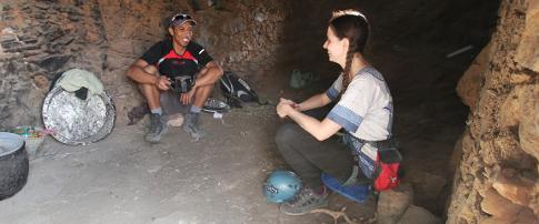
Sometime in the early 1800's, the hermit died in his home on the summit of Jebel el Kest, and his remains were laid to rest in a specially made tomb, which can still be seen on the southeast side of the residence.Today, the structures are no longer inhabited, but are frequently used by tourists to enjoy a sheltered mountain-top lunch or glass of mint tea. Please feel free to explore, but do so with respect, and take great care with fragile structures.
Hiking Routes
The summit of Jebel el Kest can be reached without any technical climbing skills, but the terrain is rough and often pathless - even the four recognised 'paths' are indistinct and almost impossible to follow when you don't know where you're going. It is therefore strongly recommended to hire a local guide for your ascent, who will be able to arrange overnight accommodation if required at Tagdicht, and ensure a trouble-free ascent of the mountain. Experienced hill-walkers may prefer to make the ascent unguided, but please take care - navigation is difficult, the terrain is hostile, and there are no rescue services. The Jebel el Kest summit map (available here) is recommended for all parties making unguided ascents.
Numerous popular routes lead to the summit, as shown below...
Tourist Path from Tagdicht
Adventure companies usually make the ascent over two days from the Ameln valley, incorporating an overnight stop in the village of Tagdicht at approximately 1500m above sea level. From the village, the 'tourist' route leads up to the summit via the northeast ridge of the summit pyramid. This strategy provides a superb experience of local culture, as well as the ascent itself. Guides also offer one-day itineraries, taking jeeps up as far as Tagdicht before continuing on foot.
The 'tourist' path is the easiest means of ascent. It ascends to the col between the south and north summits, before finishing up the northeast ridge - this is the only non-technical route up the final summit pyramid.
From Afantinzar - the Northern Approaches
The high valley of Afantinzar runs east to west along the north side of Jebel el Kest, and whilst this remote mountain region is very popular with rock climbers, the two paths up the northern slopes of Jebel el Kest see very little traffic. Afantinzar is reached via a fairly long drive from Tafraout, and as there are no tourist services or accommodation available in the valley it is only the extremely dedicated hiker, or guided trekking party, that will pass this way. That said, an ascent up the Afantinzar or Ait Yftan paths, over the summit of Jebel el Kest, followed by a descent to Ameln via Tagdicht offers one of the finest multi-day itineraries available in the range - suitable only for guided parties or those very experienced in back-country trekking. For more information about these superb multi-day trekking opportunities, Tafraout Aventure or Brahim Bahou are a good place to start.
The Anergui Path
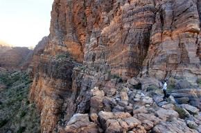
Although not as popular with trekking groups, the Anergui path is commonly used to access the superb scramble up the South Ridge, or as a descent route for climbers completing long routes on Anergui's Upper Crag. For walkers, the ascent involves a relatively straightforward hike into the high meadows below the southwest face and South Col. From here it is possible to pick a way up the Great Ramp - the obvious diagonal terrace that runs across the east face from the South Col to join the Tourist Path. The ramp is the easiest way to descend from the summit back to the South Col, but navigation can be extremely difficult and the ground is pathless throughout.
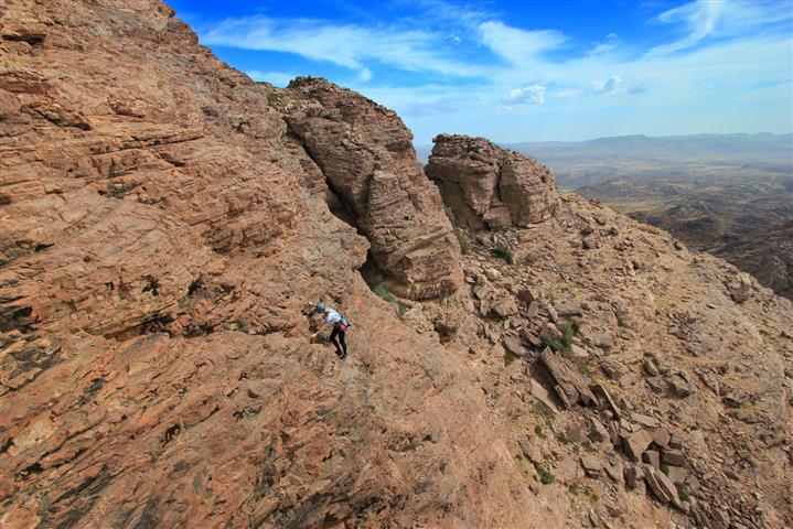
Climbing and Scrambling Routes
The summit pyramid of Jebel el Kest is a scrambler's dream, offering perfect low-angled quartzite that is generously littered with positive holds. Combine that with an exceptional setting and you've got the makings of a great day's scrambling, right to the summit of the Anti-Atlas. Be warned, however - there are hardly any visible paths up there, and finding your way back down requires a good 'mountain' sense and considerable care. The Jebel el Kest summit map is recommended for any 'off-piste' ascent.
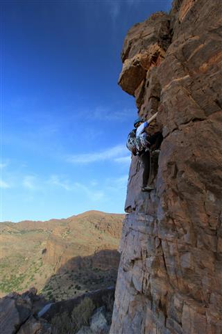
The Angel's Crest
For those with some rock climbing experience, this is undeniably the finest route to the summit, and one of the best mountain itineraries on offer in Tafraout. The route features large amounts of scrambling and very easy climbing, usually taking between 8 and 9 hours for a round trip from Anergui. It can be considered in three parts as follows:
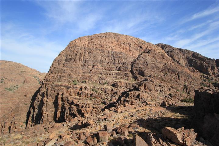
A) The ascent of the Lower Crag via the SW Ridge - the SW Ridge starts just a hundred yards or so from the village of Anergui, tracing the right-hand side of the impressive main wall of the Lower Crag. The first few pitches offer the hardest climbing as far as a large terrace, and are easily avoidable by scrambling up the gully to the right to access the terrace. Above this, a few pitches of climbing (up to Difficult) lead to easy scrambling to the top of the Lower Crag. From here, walk northwards towards the imposing, dome-shaped Upper Crag.
B) The Upper Crag via the Angel's Crest - from the col at the foot of the Upper Crag a terrace leads out horizontally leftward across the face. Follow this to it's end, from where the next 'route' climbs straight upwards. The climbing is mostly about Difficult in standard, though plenty of variations are available. Although the climbing is very easy, there is considerable exposure and a rope is advised. The climbing only lasts about 160m or so, until walking and scrambling lead to the summit of the Upper Crag. Continue walking over this until the striking pyramid-like summit of Jebel el Kest comes into view ahead.
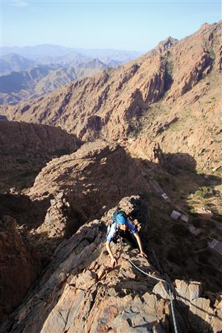
C) The summit pyramid via the South Ridge - walk across pathless terrain to the South Col, on the right of the pyramid. From here follow cairns out left across the easy-angled rocky face to a gully. Go up this a short way, then climb out leftwards up the face to gain another vague 'terrace'. Follow cairns leftwards over this to a gully, which runs up rightwards towards to a dead-end below the ridge itself. A narrow ledge leads leftward across the face, with a short steep step up at its end to gain easier ground. Trend generally up and back right towards the ridge, and finally scrambly ground up to the summit.
The West Face
The tempting triangular west face of the summit pyramid can be taken direct from the meadows above Anergui. It is described as a worthwhile scramble with a short steep section low down. The route contains about 300m of scrambling and a short crux up to about Hard Severe.

Planning an ascent of Jebel el Kest?
A walk, climb, or scramble to the top of the Anti-Atlas is one of the most memorable experiences to be had in the Tafraout region, with unparalleled views across the Anti-Atlas mountains and semi-desert beyond.
If you're planning an unguided ascent then we recommend the 1:25000 OAC Adventure map, which is the only detailed map currently available. You can get your copy right here, with secure card payment and worldwide delivery...